
Guide for schools, Youth Unions, communes and wards
Heritage site digitization and digital maps of red addresses: ideas for schools, Youth Unions and communes
What heritage digitization is, its forms and why it matters for education and tourism; how to build a digital map of red addresses, 360° virtual tours, QR codes and audio guides step by step, and how to use digital heritage in lessons and Youth Union and Pioneer activities.
Quick summary
- Heritage digitization brings a site's images, spaces, materials and stories online.
- Small units can start with QR codes, a 360° virtual tour, a digital map of red addresses or an audio guide.
- Historical information should come from reliable sources and be reviewed by the site's managers.
- Digital heritage proves its value when used in lessons and Youth Union and Pioneer activities and updated regularly.
What is heritage site digitization?
Heritage digitization means recording a site's images, spaces, artifacts, materials and stories and putting them online so people can view and learn about it on phones and computers at any time. It does not replace the real site; it helps the site become better known and better preserved.
A historic site digitization project usually combines several parts:
Photos and video
Capture the whole view, architectural details, artifacts, steles and festival activities.
360° virtual tour
360° panoramas linked into a tour that viewers rotate and move through.
3D models
3D digitization of sites, artifacts and monuments to view from every angle and zoom into details.
Materials and stories
How the site came to be and the events and people linked to it, written briefly and clearly.
Audio narration
Narration recorded as voice, played on site by QR code or during the virtual tour.
Digital map
The site's location on a map, with directions and links to nearby sites.
Why does digitizing historic sites matter for education and tourism?
Livelier history lessons
Teachers open the virtual tour in class so students “visit” the site before a field trip.
Long-term preservation
Images, materials and witnesses' accounts are saved before they deteriorate or fade away.
Promoting local tourism
Visitors find the site online, preview the space, learn how to get there and hear narration on site.
Open at all times
People far away, older people and people with disabilities can still take a virtual tour.
Bringing the community together
Residents and members contribute photos and stories and take more pride in local traditions.
What are red addresses? What does a digital map of red addresses include?
“Red addresses” is the familiar name for revolutionary historic sites, heritage houses, memorials and martyrs' cemeteries, places marking local historical events and figures. They are often chosen for heritage education and “back to the roots” trips by Youth Union and Pioneer units and schools.
Whether you are looking into red addresses in Da Nang, Hue, Thai Nguyen, Can Tho, Quang Ninh or any other province or city, building a digital map works the same way. Many localities and Youth Union organizations already have digital maps of red addresses and use them regularly. A good map usually includes:
Points on the map
Each red address has an accurate location, grouped by commune or ward or by theme.
A page for each point
Photos, a short history, audio narration and a 360° tour where available.
Directions and suggested routes
Open turn-by-turn directions on phones; suggested routes linking nearby points.
QR codes on site
A QR board at each point that opens exactly that point's page.
Digitization formats suited to schools, youth cells, communes and wards
You do not need everything at once. Small units can choose one or a few formats within their capacity:
QR codes at the site
The simplest start: a short introduction page with photos and narration, with a QR code at the gate or information board.
360° virtual tour
A few 360° points are enough to convey the space; suitable for small sites and heritage houses.
Digital map of red addresses
Suitable for commune or ward Youth Unions or schools presenting many local sites in one place.
Audio narration
A few minutes of clearly read narration lets visitors explore on their own without a guide.
3D models of artifacts
Suitable for valuable artifacts, monuments and steles that deserve close inspection.
Heritage digitization plan: step by step
Step 1: Survey and choose sites
List the sites in the area, visit them to check their condition and choose priority sites and a format for each.
Step 2: Ask the site managers for permission
Contact the management board, local authority or caretaker to ask permission to photograph and place QR codes, and agree on content.
Step 3: Shoot photos and 360° panoramas
Pick a bright, quiet time; capture wide views, details and artifacts; note the name and position of each shot.
Step 4: Collect and verify information
Take materials from reliable sources such as the site's management board, local history books and witnesses, and cross-check before use.
Step 5: Write narration and record
Keep it short and easy to listen to; ask the site managers to review it; record with a clear voice.
Step 6: Publish and place QR codes
Put it on a website or digital map, test it on several phones, print weatherproof QR boards and place them at the site.
Tips for photographing and collecting materials at historic sites
Respect places of worship
Dress properly, keep quiet and ask before photographing shrines, altars and precious artifacts.
Mind people in the frame
Avoid clear shots of residents' or visitors' faces without their consent.
Take notes on the spot
Note the point's name, shooting direction and text on steles and signs so the narration is accurate later.
Do not guess
If information is unclear, mark it “being researched” or leave it out rather than writing assumptions.
Cite sources
Old photos, accounts and quotes should say whose they are and where they came from.
Using digital heritage in lessons and Youth Union and Pioneer activities
History and local studies lessons
Open the virtual tour on a projector; students observe and answer questions about the site during class.
Preparing for field trips
Students preview the site so the trip is focused; afterwards they write reflections and add photos.
“Back to the roots” trips
Youth Union and Pioneer units follow a route on the red address map, scanning QR codes for narration at each point.
Quizzes and discovery games
Question sets on local red addresses for flag ceremonies and school festivals.
Young narrators
Students practise writing and reading narration, recorded as part of the digital site.
Maintaining and updating digital heritage
Assign someone in charge
The commune or ward Youth Union, the school or the site management board updates content with its own admin account.
Check QR codes regularly
Test-scan QR codes, replace faded boards and check that links still work.
Add content over time
Add festival photos, new activities, witnesses' stories and new sites to the map.
Track views
Views and scans show which points draw interest and help plan the next activities.
Common mistakes in heritage digitization
Unverified information
Unsourced articles from the internet lead to wrong names, years or events.
Dark, blurry or tilted photos
Rushed, poorly lit shots make the virtual tour hard to view and less appealing.
QR codes leading to error pages
Temporary links, expired shared files or documents that do not open on phones.
Built but unused
Not introduced to schools and residents or tied to activities, so few people know about it.
Frequently asked questions
What is heritage site digitization?
It means recording a site's images, spaces, artifacts, materials and stories and putting them online through photos, 360° virtual tours, 3D models, audio narration, digital maps and QR codes.
Does 3D digitization of a historic site need expensive equipment?
Not necessarily. Many small sites only need good photos and a 360° tour. Detailed 3D models suit valuable artifacts and monuments and are best done with an experienced team.
Is permission needed to photograph and place QR codes at a site?
It is best to ask the site's management board or local authority before shooting or placing QR boards, and to invite them to review the content before publishing.
Can a virtual tour replace a real visit?
It does not replace it; it complements it. A virtual tour helps students prepare for a trip, lets people far away learn about the site and makes the site better known.
Where should a digital map of red addresses start?
Start with a few representative red addresses with good photos and verified information, then add more. The map should allow new points without being rebuilt.
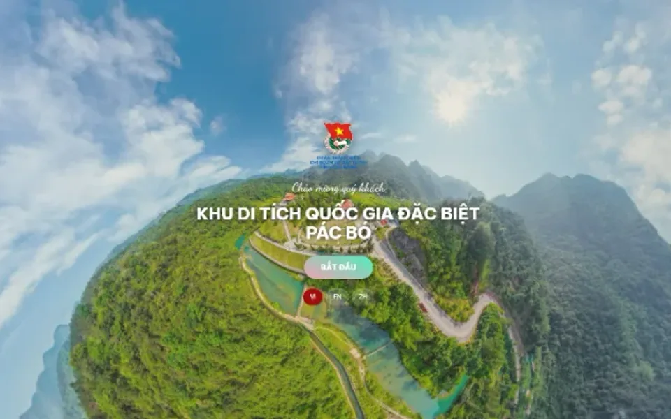 Youth project
Sample product
Digitization of the Pac Bo special national relic site
Try a similar digital product live on a computer or phone. Real products are built around your own idea.
View demo (opens in a new tab)Need to digitize a historic site or build a digital map of red addresses?
We suggest ideas and work with you to build the digital products: red address maps, 360° virtual tours, 3D models, audio narration and QR boards. Usually within 3–10 days once the materials are ready.
Related articles
See all articlesDigital youth projects
Ideas for digital transformation youth projects for schools, communes, wards and youth cells, and Pioneer projects for school-wide and class Pioneer units; how to choose an idea, steps from registration to handover, mobilizing resources and keeping the project alive after launch.
Read80 years of War Invalids and Martyrs Day
Ideas for gratitude activities marking the 80th anniversary of War Invalids and Martyrs Day for schools, Youth Unions, communes, wards and veterans' associations: traditional activities, lasting digital activities, respectful handling of martyrs' names and photos, and milestones before 27 July 2027.
ReadVirtual museums in teaching
What virtual museums and exhibitions are, their types and benefits for teaching history, geography, literature, the arts and STEM; steps to make a 3D virtual museum, free tools, lesson ideas and how to let students create their own exhibitions.
Read